Feeds:
Posts
Comments

Archive for the ‘East Coast trip’ Category

DSC_0244 
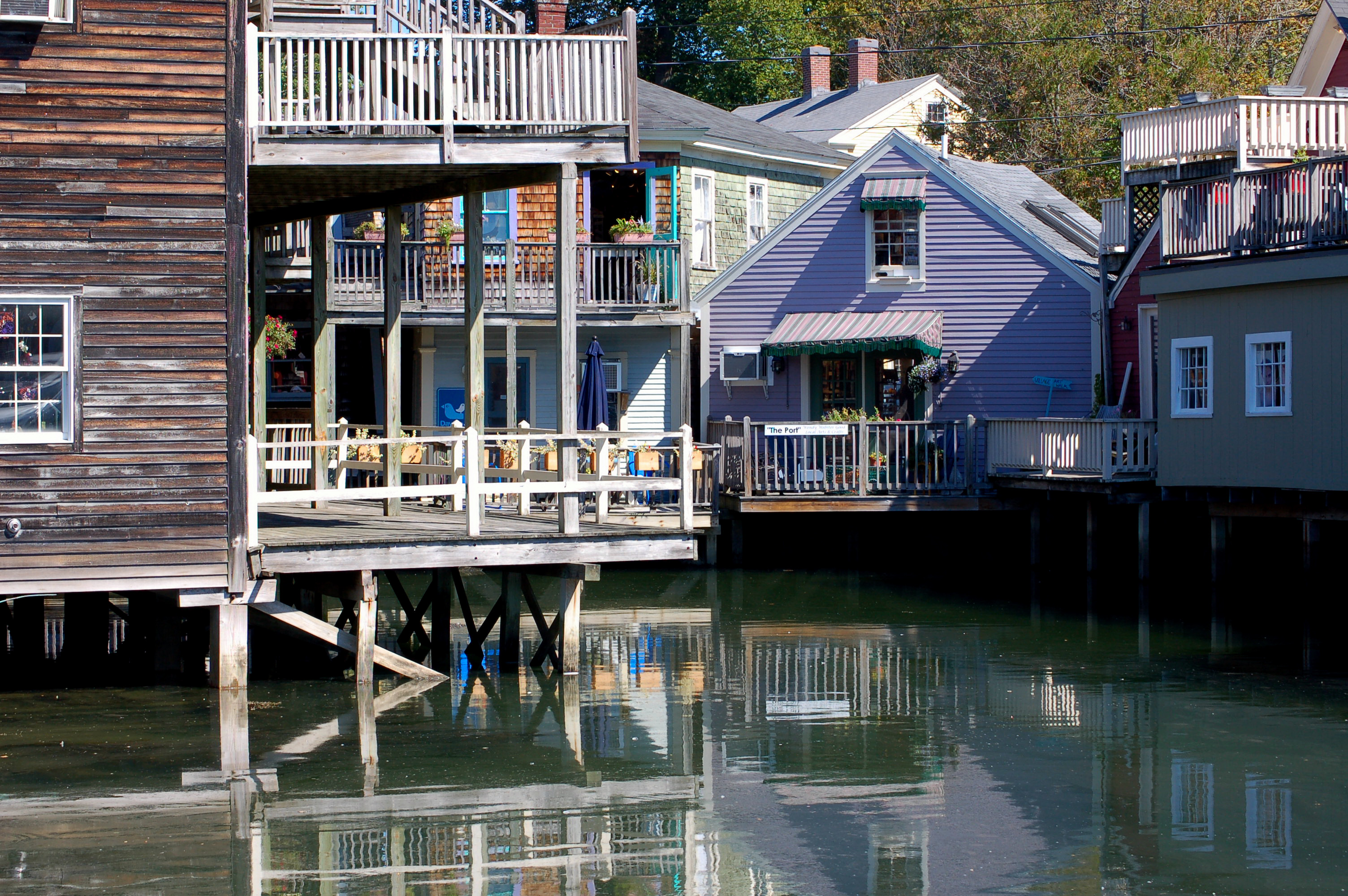
The community of Bar Harbor (Pronounced Ba Haba to native Mainers.) is located on Mount Desert island. It is along the shoreline, and bay areas. During the 1880’s this area had become populated with wealthy, and powerful people. Today, the community gears towards the tourism industry. of course, lobster fishermen abound here, too. (Lobster is pronounced lobsta by the local folks.)

DSC_0229                                                DSC_0154

A great fire in 1947 destroyed much of the area. A large percentage of the community was lost due to this fire. Of course, Bar harbor has been rebuilt, and is thriving.

A friendly crow!

A friendly crow!

The lobster industry is visibly present everywhere. One will notice fishermen color-coded buoys scattered throughout the bay. The shorelines will show lobster traps here, and there. I actually ate my first lobster on this trip. I found the lobster good to the taste buds, but nothing that special over other kinds of seafood.                           DSC_0235

DSC_0157 
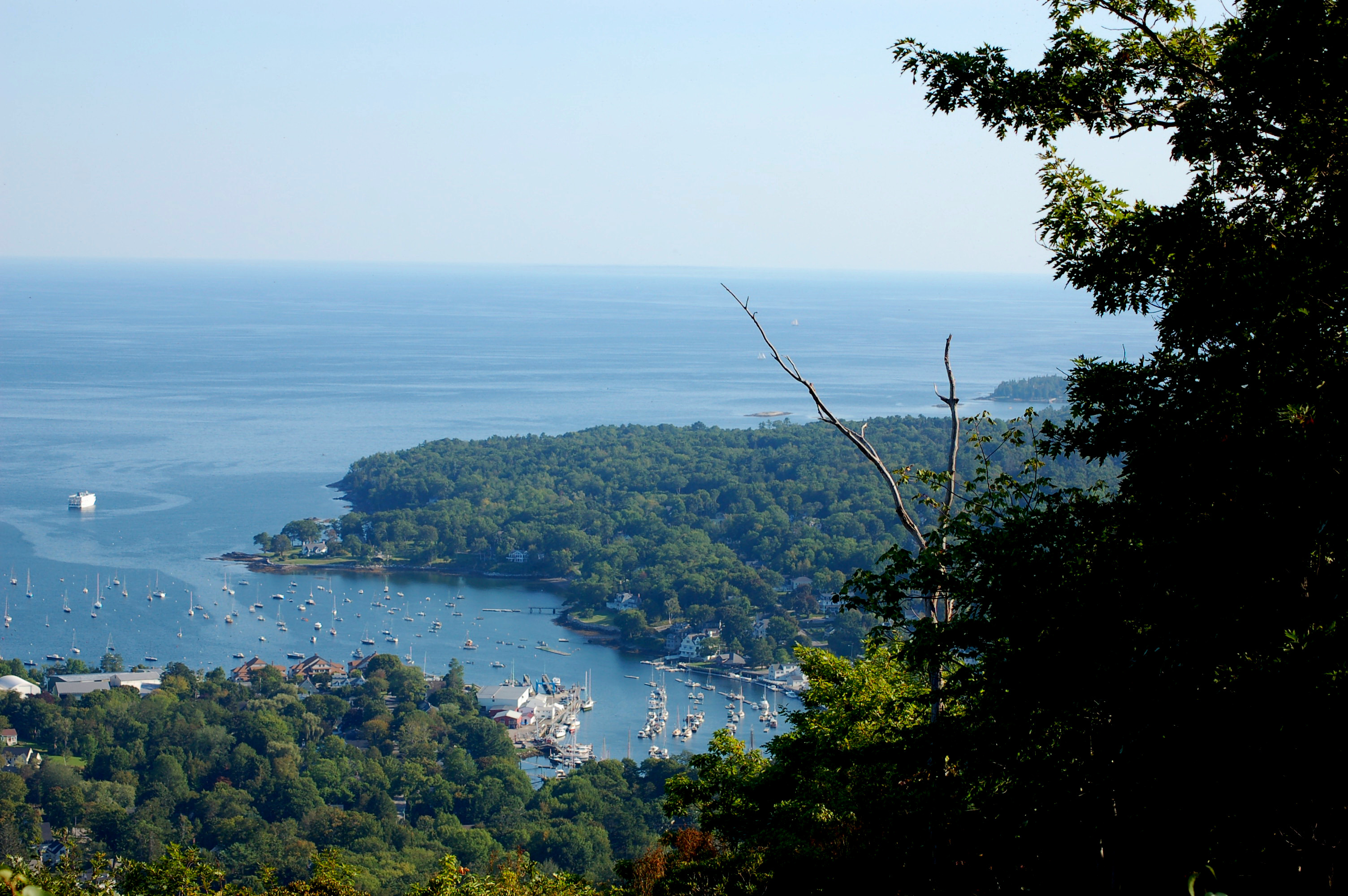
Laurie, and I, walked the “Shore Path” to observe the bay area. The actually path that is along the shoreline is about three-quarters of a mile long. Additional path goes back, and around, the community.


Beached jellyfish

Beached jellyfish

Jellyfish

Jellyfish

We could see the Porcupine Islands as we strolled. We saw many gulls about, as well as, five purplish-colored jellyfish. Later, we found one on the shore as the tide had become low exposing more shoreline.


Low Tide

Low Tide

DSC_0164 The bay area was inundated with many boats, ships, and windjammers.  Some of which resembled eighteenth century ships.


Restaurant at night.

Restaurant at night.

Read Full Post »

DSC_0169What a view! Those words may best describe the sights from the area known as Cadillac Mountain. The vantage point allows for seeing distant islands, called the Porcupine Islands, and the Bar Harbor community, and port. Not to mention, the Atlantic ocean.

DSC_0172DSC_0170DSC_0175

This mountain was  named Green Mountain in past years.  In the early years of French exploration the area was considered part of New France. Those years covered 1534 to 1763.

DSC_0184

Since 1918, the mountain was named in honor of French explorer, Antoine …Cadillac. The name in reality is a long one. I chose to shorten it here!DSC_0174As previously stated, one can see forever on a clear day. We were lucky for the day was clear. Others visiting the mountain only see fog covering everything below them.                                                                           DSC_0176

The top of the mountain has many volcanic rocks exposed. they are granite with a pinkish hue. I read the pink color comes from pink feldspar particles imbedded in the granite.DSC_0173Vegetation was mostly spruce trees with some birch scattered among them. Other short shrubs were set about the rocks wherever seeds could take hold and grow.

Cadillac Mountain is part of over twenty mountains on Mount Desert Island. This site is on an island, and is part of the Acadia National Park.


Read Full Post »


DSC_0216 The Acadia National Park offers many beautiful sites to see. This area of the park is on an island known as Mount Desert Island. Maine is not known as a mountainous state, but there are impressive highlands on the island and nearby country. In fact, because of the clear weather we witnessed we could see a lone mountain on the mainland over a hundred miles away.                                                        DSC_0212

DSC_0208  One of the sites we saw is known as Thunder Hole. This place is  DSC_0187named because of the results of thunderous waves being compressed within a cavern-like rocky area. As the waves recede it cause a vacuum of air in the cavern causing  the sound of a distant clap of thunder.

Unfortunately, the waves were not that big as we watched, and the thunder was weak. On a day of waves the water here may reach heights of forty feet.

DSC_0192  Occasionally rouge waves occur. People getting too close have been washed to sea. A loss of life can happen, and has happened, in the event of the rogue waves.                              DSC_0190

Huge rock outcroppings are visible all around the Thunder Hole area. They are known as Otter Cliffs. Some of these cliffs top a hundred and ten feet in height. They were beautiful to see

I was fortunate with photos since the lowering sun was creating darkened shadows of contrast. I hope you enjoy a few of the photos included here.

Read Full Post »

Portland Head Light

Portland Head Light

Laurie, and I, visited the Portland Head Light while traveling in Maine. I never heard this wording before, since I call them light houses. This one has supplied light in the harbor for over 200 years old, and the structure was built in the end of the eighteenth century.                        DSC_0072

The lighthouse was originally built at fifty feet tall. Later, it was added to, and reached 80 feet  in height.

DSC_0074  The completion of the lighthouse occurred in 1791. This happened after George Washington, in 1790, authorized $1500.00 to have it completed. Earlier funding of $750.00 wasn’t enough to built the lighthouse.                                        DSC_0087

DSC_0079 Interestingly, the first lighting was supplied with whale oil.  DSC_0080

The building around the lighthouse was completed in 1891.

Another lighthouse in distance.

Another lighthouse in distance.

DSC_0093   Rocky outcrops jut out into the bay creating some beautiful contrasts, and photo opportunity. Gull would land to rest on these rocks. We saw some dolphins in the water, but I failed to be fast enough for any photos.


Read Full Post »

DSC_0131 Being the nature snooper I am, I made sure to be down along the low-tide beaches in the early morning. I wanted to watch the sun rise. I planned for many photos, and many photos I did take!   DSC_0134

The pre-dawn moments were already alive with wildlife movements. Gulls were flying about. I saw a loon. Crows were cawing. I saw several Great Blue Herons as the seconds towards sunrise moved quickly.                                                     DSC_0137DSC_0140The beach, at low tide, had much seaweed, and rock weeds. These plants were of a yellow color, and extremely slippery to tread on. various mussels, and snail shells covered the beach. I gathered a few to give as gifts.              DSC_0254                                                                                       DSC_0139

I saw movement at my feet, and was surprised to see some unknown specie of crab. I played around with the little guy for a time. However, I stayed clear of anything that might pinch!

Great Blue Heron

Great Blue Heron

DSC_0143  I saw a slight bright crescent on the horizon line. It was the sun! I stood amazed as to how quickly the bright globe headed upwards. One could actually see the movement.              DSC_0146

I just walked about the beach taking photos as I walked along. As you have seen, I included some of the shots here to see the movement over a ten minute, or so, time frame.

A Loon.

A Loon.

Read Full Post »

Camden Harbor

Camden Harbor

Many years ago I learned of the Indian tribe known as the Penobscot Indians. Members of this tribe still live in Maine. They are supplying time at Acadia National Park repairing a native wigwam for educational purposes.

Penobscot bay

Penobscot bay

Laurie, and I, visited the community of Camden Harbor during our eastern excursion. This harbor is part of the big picture of Penobscot Bay. While walking along I couldn’t help thinking of the movie, “The Birds.” Remember that movie was filmed along a coastal area. DSC_0064Since, Laurie isn’t a big shopper for the most part we sat on a bench and talked with a few local veterans. We spent about forty minutes talking about politics, and girl watching! (The older fellows, not me!)

DSC_0061

Camden looks the part as a fishing community. Lobster places are everywhere. Shipbuilding played a big part to the community in years past, as well as, the lobster industry.

DSC_0111The Penobscot Bay is the result from the Penobscot River draining  DSC_0058into the harbor. Of course, the Atlantic Ocean plays a much bigger part in supplying the water. (That’s a joke, in case, you didn’t get it!)

We traveled uphill to Mount Battie of the Camden Hill’s State park. At this site we could look forever into the distance. The bay meanders all around including Camden. From this height we could see a part of the Camden Harbor including the community buildings. What a view!  This panoramic view was a thrill to witness.                                                      DSC_0103

DSC_0122  DSC_0114  The one thing Laurie, and I, witnessed was the wealth of this area, and the many other communities. We saw the President George Bush (41)estate near Kennebunk. Various celebrities own homes on, or about, Maine islands. Many wealthy people build, or purchase multi-million dollar summer homes here, too! (Note the homes are summer homes!) The homes are beautiful styles typical of the area.

We visited Kennebunkport, too. This is another area primarily for the tourists. Some of the very old homes have black stripes around the chimneys to designate the homes of Tories during revolutionary War times. The Tories were people sympathetic to England, and not those attempting towards independence.

Read Full Post »

DSC_0036  Laurie, and I visited Boston Harbor last week.  Boston Harbor  is the waterway bordering the city of Boston, Massachusetts. This area was discovered by John Smith in 1614 during the time when European explorers were searching for lands; freedoms, and/or wealth.   DSC_0038

Many sites around Boston are known by history buffs!  I have heard the area called the, “Cradle of Liberty.” Much activities surrounded Boston Harbor in those years beginning in 1770, prior to the Revolutionary War of Independence from England!

City of Boston taken from the Cruise ship.

City of Boston taken from the Cruise ship.

In March 1770, the infamous, “Boston Massacre” occurred when Colonial civilians angry with the taxes  Great Britain was demanding of them were shot upon. Some were killed! The seeds of revolt were firmly entrenched now.

DSC_0009

Later, in 1773, a group of patriots disgusted with Britain’s Tea Act threw the tea into the Boston Harbor. This has been called the Boston Tea party.

Boardwalk in Boston

Boardwalk in Boston

The American experiment began in earnest in 1775 at Boston. Students from my era learned of the Old North Church in Boston. (We saw the church.) The lesson learned was , “One if by land, and two if by sea” The watched in the church was to place one light if British soldiers came to Boston  via land, or place two lanterns if the troops came  by sea.DSC_0026

We saw the Battle of Bunker Hill Monument, too. The structure looks like the Washington’s Monument of D.C. This battle occurred in 1775 during the siege of Boston. The battle was considered a British victory although their casualties were high.

Cormorants, and a gull.

Cormorants, and a gull.

Laurie, and I walked about on the boardwalk for a time seeing many gulls, and cormorants. I watched an osprey flying overhead, too.

Many of the photos shown here were taken as we did a cruise of the harbor. I took many photos from the upper deck of the cruise ship. We saw the U.S.S. Constitution (Old Ironsides) docked for maintenance. This ship was one of six that were built. This frigate was launched in 1797, and used in the War of 1812.

The harbor has a number of islands. We saw many, many boats, and ships all about the harbor.                                           DSC_0049

Read Full Post »